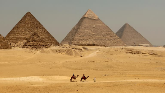
The Intersection of Geography and Civilization: An Overview
The development of human civilization is inextricably linked to the physical landscapes upon which it unfolds. Geography is not merely a passive backdrop to human history; it is an active, dynamic force that dictates agricultural viability, economic development, strategic defense, and cultural evolution. By examining the intricate topographies of diverse nations, we can decode the underlying mechanisms that have propelled human societies from isolated settlements into complex, globally integrated superpowers.
In this comprehensive analysis, we explore three distinct yet profoundly illuminating case studies: Egypt, the United States, and Pakistan. Each of these nations represents a unique geographical paradigm. Egypt demonstrates the delicate balance between life-giving river valleys and isolating, protective deserts. The United States offers a masterclass in how a vast, resource-rich continental expanse, buffered by two oceans, can facilitate the rise of a modern superpower. Meanwhile, Pakistan serves as a testament to the resilience required to thrive amidst extreme landforms, where towering mountain ranges, arid plateaus, and fertile river plains converge to create a highly diverse and strategically critical nation.
The Foundational Elements of Geographic Determinism
To truly understand national trajectories, we must first dissect the core geographic elements that influence state formation. Mountains act as natural fortresses and climate barriers, deserts serve as formidable defensive shields while simultaneously restricting expansion, and river systems function as the vital arteries of trade, agriculture, and early urbanization. The interplay of these elements creates a unique geographical matrix for every nation, determining where populations concentrate, how wealth is generated, and what external threats must be mitigated.
- Riverine Lifelines: Fluvial systems like the Nile, Mississippi, and Indus rivers provide the necessary freshwater for agriculture, enabling population density and serving as natural highways for internal commerce.
- Topographical Barriers: Mountain ranges such as the Appalachians, the Rockies, and the Himalayas dictate historical migration patterns, protect against invasions, and influence regional weather systems through the rain shadow effect.
- Climatic Zones: The variation in climate—from the arid Sahara to the temperate American Midwest and the extreme alpine conditions of northern Pakistan—dictates agricultural output and necessitates unique architectural and societal adaptations.
Understanding these foundational elements allows us to appreciate how geographical constraints and opportunities have been navigated by human ingenuity over millennia. The subsequent sections will delve deeply into how these forces have manifested specifically in Egypt, the United States, and Pakistan.

Egypt: The Gift of the Nile Amidst the Sahara
The Greek historian Herodotus famously proclaimed Egypt to be the “gift of the Nile,” a statement that succinctly captures the existential reliance of this ancient civilization on a single geographic feature. Egypt’s geography is a study in stark contrasts: the hyper-arid expanse of the Sahara Desert juxtaposed against the lush, hyper-fertile ribbon of the Nile River Valley. This dichotomy has shaped every facet of Egyptian life, from its ancient religious pantheon to its modern geopolitical strategies.
The Lifeline of Antiquity: Nile River Dynamics
The Nile River is the longest river in the world, flowing northward from the heart of Africa to empty into the Mediterranean Sea. For ancient Egyptians, the river was not just a water source; it was a deity, an agricultural engine, and a unifying highway. The predictable annual flooding of the Nile, known as the inundation, deposited nutrient-rich silt along its banks, transforming the barren desert into highly productive arable land. This agricultural surplus allowed for the stratification of society, the rise of a specialized labor force, and the construction of monumental architecture like the pyramids and temples.
Furthermore, the Nile served as a natural conduit for transportation and communication. The prevailing winds blow from north to south, allowing sailing vessels to travel upstream against the current, while the river’s flow effortlessly carried boats downstream. This dual-directional navigability facilitated a highly centralized state, allowing pharaohs to project power, collect taxes, and distribute resources efficiently across the vast length of the country.
Desert as a Shield: The Sahara’s Role in Egyptian Continuity
While the Nile provided life, the surrounding deserts provided security. To the west lies the Libyan Desert, an unforgiving sea of sand dunes that formed an impassable barrier to mass land invasions. To the east, the Eastern Desert and the Red Sea offered similar protection, while the formidable cataracts (rapids) of the southern Nile hindered incursions from Nubia. This unique geographical isolation allowed ancient Egyptian civilization to develop continuously for over three millennia with remarkably few successful foreign conquests compared to the volatile civilizations of Mesopotamia.
However, the desert was not entirely barren of value. The Eastern Desert and the Sinai Peninsula were rich in mineral wealth, including gold, copper, and semi-precious stones. These resources fueled the opulence of the pharaonic courts and provided the raw materials necessary for early metallurgy and monumental art. The relationship between the fertile valley and the arid desert created a self-sustaining ecosystem that defined Egyptian resilience.

The United States: A Tapestry of Landscapes from Colony to Superpower
The geographical narrative of the United States is one of unprecedented continental expansion and the mastery of diverse, resource-rich landscapes. Bounded by the Atlantic Ocean to the east and the Pacific Ocean to the west, the United States possesses an enviable strategic depth. Its internal geography—characterized by navigable river networks, vast fertile plains, and protective mountain ranges—has been the primary catalyst in its transformation from a collection of precarious eastern colonies into the world’s preeminent superpower.
The Eastern Seaboard and Appalachian Barrier
The initial European colonization of North America was heavily dictated by the geography of the Eastern Seaboard. Deep-water natural harbors like those in Boston, New York, and Charleston facilitated crucial transatlantic trade with Europe. The coastal plain provided sufficient arable land for early agriculture, but westward expansion was immediately checked by the Appalachian Mountains. This ancient, rugged mountain range acted as a natural containment zone, forcing the early colonies to grow denser, develop robust internal economies, and forge a unified political identity before spilling over into the interior.
The Vast Interior: Mississippi Basin and the Great Plains
The true geographical engine of American power lies in its vast interior. Once settlers breached the Appalachians, they encountered the Mississippi River Basin, the largest contiguous network of navigable rivers in the world. The Mississippi, along with its massive tributaries like the Missouri and Ohio rivers, provided a ready-made, cost-effective transportation system that linked the deep interior to the global ocean via the Gulf of Mexico.
Overlaid upon this river network are the Great Plains, a massive expanse of flat, incredibly fertile land that serves as the global breadbasket. The combination of high-yield agricultural land and cheap, waterborne transport allowed the United States to generate immense capital and achieve food security, freeing up a significant portion of its population to engage in industrialization and technological innovation.
| Geographic Region | Key Topographical Features | Economic & Historical Impact |
|---|---|---|
| Eastern Seaboard | Natural harbors, coastal plains, Atlantic access | Early colonial settlement, transatlantic trade, financial hubs. |
| Appalachian Mountains | Rugged, heavily forested ancient peaks | Early barrier to expansion, rich in coal driving the industrial revolution. |
| Mississippi Basin | Extensive navigable river network, fertile soil | Agricultural dominance, cheap internal transport, geopolitical integration. |
| Western Frontier | Rocky Mountains, arid deserts, Pacific coastline | Mineral wealth (Gold Rush), tech innovation hubs, Pacific trade access. |
The table above illustrates how distinct regional geographies within the United States contributed sequentially to its national development. The integration of these diverse zones via railroads and highways in the 19th and 20th centuries solidified the nation’s economic supremacy.

Pakistan: Extreme Landforms and the Crossroads of Asia
Pakistan is a nation defined by geographical extremes and strategic positioning. Situated at the crossroads of South Asia, Central Asia, and the Middle East, its landscape is a dramatic tapestry of towering alpine peaks, expansive river plains, and harsh, arid plateaus. This complex geography has not only shaped the diverse ethnic and cultural makeup of the country but also dictates its modern economic challenges and geopolitical significance.
The Majestic Northern Highlands: Himalayas, Karakoram, and Hindu Kush
The northern region of Pakistan is dominated by three of the world’s most formidable mountain ranges: the Himalayas, the Karakoram, and the Hindu Kush. This area is home to K2, the second-highest peak on Earth, and holds some of the largest non-polar glaciers in the world. These mountains serve multiple critical functions. Geopolitically, they form a massive, virtually impenetrable natural fortress that historically protected the subcontinent from northern invasions, save for specific mountain passes like the Khyber Pass, which became historical arteries for conquerors and trade caravans alike.
Environmentally, these glacial highlands are the ultimate source of Pakistan’s lifeblood. The seasonal melting of snow and glaciers feeds the Indus River system, without which the country’s agricultural sector would collapse. However, this extreme topography also isolates communities, making infrastructure development incredibly difficult and fostering distinct, fiercely independent local cultures.
The Indus River Plain: The Agricultural Heartland
Descending from the northern highlands, the geography transitions dramatically into the Indus River Plain. Much like the Nile in Egypt, the Indus River is the central artery of Pakistan. The plain is divided into the upper Punjab region—the “Land of Five Rivers”—and the lower Sindh region. This vast, flat expanse of fertile alluvium supports the overwhelming majority of Pakistan’s population and agricultural output.
The historical significance of this region cannot be overstated. It was the cradle of the ancient Indus Valley Civilization, with sophisticated urban centers like Mohenjo-Daro thriving on the agricultural surplus generated by the river. Today, the Indus Basin Irrigation System is the largest contiguous irrigation network in the world, a monumental feat of engineering necessary to sustain agriculture in a region that otherwise receives minimal rainfall.
- Punjab Province: The agricultural and demographic core, benefiting from the convergence of five major rivers. It drives the national economy through wheat, cotton, and rice production.
- Sindh Province: The lower riparian zone, heavily dependent on upstream water flow, culminating in the Indus River Delta, a critical ecological zone currently threatened by reduced freshwater flow and seawater intrusion.
- Balochistan Plateau: Covering nearly half of Pakistan’s landmass, this arid, rugged, and sparsely populated western region is rich in unexploited minerals and features a long coastline along the Arabian Sea, housing the strategically vital deep-water port of Gwadar.
The interplay between these distinct zones requires delicate national management. The wealth generated in the fertile plains must be balanced with the developmental needs of the rugged, resource-rich, but infrastructurally isolated western plateaus.

Comparative Analysis: How Geography Dictates National Destiny
When analyzing Egypt, the United States, and Pakistan side-by-side, profound patterns emerge regarding how geography dictates national destiny. While their specific landforms differ wildly, the underlying mechanisms of geographic determinism—strategic depth, resource allocation, and natural borders—operate on remarkably similar principles across all three nations.
Strategic Depth and Natural Borders
Strategic depth is the geographical distance between the front lines or national borders and the core population or industrial centers. The United States possesses the ultimate strategic depth. Buffered by two massive oceans, it is virtually immune to conventional land invasion from rival superpowers. Its only land borders are shared with weaker, friendly neighbors, allowing it to project military power globally without fearing for its homeland security.
Egypt also benefited historically from profound strategic depth, though of a different nature. The vast expanses of the Sahara and the Eastern Desert acted as impenetrable oceans of sand, protecting the Nile Valley core. Pakistan, conversely, faces a more complex security environment. While its northern mountains provide an excellent natural barrier against Central Asia, its long, flat eastern border with India lacks defining geographical obstacles, leading to historical and ongoing geopolitical tensions and the necessity of maintaining a large standing military.
Resource Allocation and Economic Hubs
The spatial distribution of geographical resources directly dictates where economic hubs develop. In Egypt, the absolute necessity of water means that 95% of the population lives on roughly 5% of the land—the immediate vicinity of the Nile and its delta. This creates hyper-dense urban centers like Cairo and Alexandria, centralizing economic and political power.
The United States, blessed with abundant, widely distributed resources, developed multiple, decentralized economic hubs. The East Coast serves as the financial and political center, the Midwest as the agricultural and manufacturing heartland, and the West Coast as the nexus of technology and Pacific trade. Pakistan’s economic geography mirrors Egypt’s reliance on a central river system, with major economic activity clustered along the Indus in cities like Lahore and Karachi, though its western province of Balochistan remains an untapped frontier due to severe topographical and climatic challenges.

Modern Challenges: Climate Change and Geographic Resilience
In the 21st century, the geographical features that historically nurtured these nations are increasingly becoming sources of vulnerability. Climate change is fundamentally altering the predictable patterns of rivers, deserts, and weather systems, forcing Egypt, the United States, and Pakistan to rapidly adapt their infrastructure and economic models to ensure geographic resilience.
Water Scarcity and River Management
For nations reliant on single major river systems, water security is the paramount existential challenge. Egypt faces immense pressure from upstream developments on the Nile, specifically the Grand Ethiopian Renaissance Dam (GERD), which threatens to alter the historical flow of water reaching the Egyptian delta. Coupled with rising sea levels salinizing the fertile delta soils, Egypt must aggressively pursue water desalination and hyper-efficient irrigation technologies.
Pakistan faces a similarly dire situation. The glaciers of the Himalayas and Karakoram, which feed the Indus River, are melting at unprecedented rates due to global warming. This creates a dual threat: devastating flash floods in the short term (as witnessed in the catastrophic 2022 floods) and severe, chronic water scarcity in the long term once the glacial reservoirs are depleted. The United States is not immune to these challenges either; the Colorado River basin in the American West is experiencing historic mega-droughts, forcing drastic reevaluations of water allocation between agriculture and rapidly growing desert cities like Phoenix and Las Vegas.
Urbanization in Extreme Environments
As populations explode, urbanization is pushing human settlements into increasingly precarious geographic zones. In the United States, coastal development in Florida and the Gulf Coast faces escalating threats from intensified hurricanes, while urban sprawl in California intersects dangerously with wildfire-prone chaparral landscapes. In Pakistan, the rapid expansion of Karachi presents massive challenges in providing potable water and sanitation in an arid, coastal environment. Nations must now engineer solutions that work in harmony with their extreme landforms rather than attempting to merely conquer them.

Conclusion: The Enduring Legacy of Land and People
The exploration of Egypt, the United States, and Pakistan reveals a profound truth: while human technology and societal organization have advanced exponentially, the fundamental contours of national destiny remain deeply rooted in geography. The Nile River continues to dictate the pulse of Egyptian life just as it did during the reign of the Pharaohs. The vast, interconnected river basins and dual-ocean access of the United States remain the bedrock of its global economic and military supremacy. Meanwhile, Pakistan’s towering mountains and fertile plains continue to forge a diverse, resilient nation at the crossroads of empires.
As we look to the future, the relationship between nations and their physical environments will only become more critical. The challenges of climate change, resource depletion, and population growth require a deep, respectful understanding of geographical limits and potentials. By studying how landscapes have shaped our past, we are better equipped to engineer sustainable, resilient societies that can thrive alongside the formidable forces of nature.
Frequently Asked Questions (FAQ)
- Q1: How did the Sahara Desert influence the development of ancient Egyptian civilization?
- The Sahara Desert, along with the Eastern Desert, functioned as massive, natural defensive barriers. By isolating the fertile Nile River Valley from neighboring regions, these hyper-arid zones prevented frequent large-scale invasions. This geographical protection allowed ancient Egyptian culture, religion, and governance to develop with remarkable stability and continuity over thousands of years, unlike the frequently conquered city-states of Mesopotamia.
- Q2: Why is the Mississippi River system considered crucial to American geopolitical power?
- The Mississippi River Basin forms the largest contiguous network of navigable internal waterways in the world, overlaying some of the planet’s most fertile agricultural land (the Great Plains). This geography allowed the United States to produce massive agricultural surpluses and transport them domestically and internationally at incredibly low costs. This economic engine funded industrialization, integrated the vast interior of the country, and established the U.S. as an independent global economic powerhouse.
- Q3: How do the northern mountain ranges affect Pakistan’s climate and economy?
- The Himalayas, Karakoram, and Hindu Kush ranges are vital to Pakistan’s survival. They act as a climatic barrier, blocking cold winds from Central Asia, and house massive glaciers that feed the Indus River system. The seasonal meltwater from these mountains is the primary source of freshwater for the Indus Basin Irrigation System, which sustains the
Reader context note: This article is educational history and geopolitical commentary. It is not real-time intelligence, tactical instruction, operational planning, political campaigning, legal advice, investment advice, security advice, weapons guidance, extremist support, or endorsement of violence. Readers should check dates, sources, and multiple perspectives when evaluating conflict, disaster, security, or policy topics.
